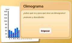
Climate graphs show average rainfall and temperatures typically experienced in a particular location. The temperature is shown on a line graph, and rainfall on a bar graph. They are usually represented on the same set of axes with the months of the year along the base.

Climate graph for London
Interpreting and describing climate graphs
- Look at the overall shape of the graph. Is the temperature line steep or gentle? Does it change throughout the year and/or look almost flat?
- Look for extremes - quote the highest and lowest temperature and rainfall and the month in which it occurs. Remember to quote units, eg Celsius or millimetres.
- Can you identify the seasons when most rain or least rain falls? Or when the highest and lowest temperatures are experienced?
- Work out the temperature range by subtracting the lowest figure from the highest figure.
- Add the rainfall totals for each month together to work out the total annual rainfall.
Information copied from:
More information in this link:
No hay comentarios:
Publicar un comentario